Posts

Showing posts with the label GIS

GIS For Everyone

Image
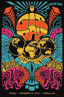
Yesterday was GIS Day. For those who don't know, GIS stands for Geographic Information Systems. And if you don't know what that is, you probably don't know what GIS Day is. Well, I'm here to tell you. GIS Day is a day focused around getting the word out about GIS, what it is, what it can do and why we need it. The running joke is that it is an ESRI sanctioned holiday. ESRI is the company that makes the most-used GIS software in the world. They are based in Redlands California and I actually have a niece and nephew that work for ESRI out there.  The owner of the company is Jack Dangermond, a  Forbes billionaire who is as down-to-earth as they come. I've had the opportunity to meet and talk to him on a few occasions. In the GIS circles, he has a cult-like following and he makes it a point to meet as many users as he can at their annual Users Conference in San Diego. He's a big deal - at least to us GIS folks. Anyway, I decided we should do something in...

Corporate Laddering

Image
So my daughter got her first "real" job out of college this week. She will be working for the Minnesota Supercomputing Institute at the University of Minnesota. It was one of two U of M jobs she interviewed for last week. She was offered both, and took this one, as it seemed more challenging and like a better fit. As a parent, there is nothing more satisfying than the sound of your kid getting a job. (A paraphrase from a friend.) That first job after an education is always the hardest. Convincing a potential employer that you are better than the part time job you're currently working is the tricky part. Once you do that and successfully land a job in a career field, you have a leg up as you begin to build experience. You're "in the system" so to speak. It's all skill building and networking after that. My friend Bill in the CADD room at Intelligraphics Inc. in 1988 My first job out of college was not nearly as lucrative as my daughter's, but ...

The Science Of Where

Image
I don't often write about my work. Part of it is intentional - a distancing between work and family life, and part is just because people don't dig GIS like I do. Mapping is great, but most people think I sit around making globes all day. It's a bit of voodoo. But as part of my job my colleagues and I all go out to San Diego for a software users conference every year. It is a gathering of 18,000+ GIS (Geographic Information Systems) professionals where we come together to network and learn about what is coming, software changes and exciting developments. It is an invaluable week, one I look forward to every year. None of this is to mention that I think San Diego is about the best place in the world, climatically. The best. This year was made even better as Waukesha County was recognized as a Special Achievement in GIS (SAG) Award winner. Every year ESRI, the software company, awards a small percentage of their user base this award. We were last recognized in 2004, so th...

Coliseums and Gladiators

Image
I just returned from a two day conference in Green Bay. It was the ESRI WI Users Group ( EWUG ) annual meeting and for the second time in 3 years it was held at Lambeau Field. The stadium has meeting rooms and banquet facilities in its atrium and it really worked out nicely for this conference. I've been to a few games at the stadium, so it was not a totally new experience for me. Every time I visit it though, I am more blown away by the behemoth that it has become. Lambeau leaves all other football stadiums in the dust with regards to fan experience. You just cant touch it. It's second to none. At the same time, during the renovations, they took a football field with history and made it into a destination. All of this was done in the interest of revenue generation, but most of it is done in good taste and with class. It reminds me of Miller Park in some respects, as it's as much an indoor mall as it is a sports venue. Not a bad thing, just not your daddy's ballpar...

ESRI UC 2012 Post Mortem

Image
I just returned from the ESRI 2012 Users Conference . As always it was jam-packed with good content about the upcoming 10.1 release of ArcGIS . The plenary, keynote and sessions were all very good. Some weak moments in the afternoon of Monday's plenary, I thought, but not too bad. One of my goals for the conference was to not walk myself to death as I've done in years past. Usually I'll walk down to Seaport Village a couple of times to have lunch, a ten minute walk each way. This year I came across a food truck right outside the center, that was serving really good Mexican food, so I had an authentic burrito there instead. Supporting the local economy, saving myself a few bucks and a little walking. Nice. One of the maps in the map gallery was the map above showing the evacuations routes in the event of a Zombie Apocalypse in Portland, OR. It was an application of GIS I'd never actually considered before. It's good to know that someone has it covered. I'd b...

Maps and Legends

I spent the tail end of last week at the WI Land Information Association (WLIA) Conference in Steven's Point. It was a map geek conference that happens every year. There were 350 land information professionals in attendance and like most every conference, we talked about our work constantly. We talked over breakfast, in the hall after the sessions, at lunch, at the social events, in the elevators and  even on the ride home. Yes, we're pretty pathetic. At the same time, I would argue that we're passionate. We love our jobs, that's why we gather every year. We share ideas, talk through problems, argue, critique and laugh. I remember one time my boss's wife went along on a conference with him and by the end of it she said "You guys never stop talking about work, do you?" The answer is nope. Oh sure we catch up on each others' families and such, but after those three minutes are up, we're back to talking about terrestrial scanners, relational dat...

A Big Fat Map Sandwich

Just returned from another successful EWUG conference in Middleton, WI ( www.ewug.org ). This conference is for techy , geeky, GIS types who get excited about new geoprocessing tools and functions, server apps, and software upgrades. Typically we talk shop until the wee hours because we forget that we have families and the like. It's really sad actually. In all truthfulness, it's not as bad as that. We try to abide by the rule that there is to be no GIS talk after 9:00 PM, which is probably a good thing anyway. If there is to be GIS talk, it has to be kept light, like software slamming or sharing the dirt on someone who was fired, etc. No talking about how to properly set up a spatial index on multiple attribute columns in a SQL Server 2008 Release 2 database. Ooops , there I go again. I'm sorry. The keynote speaker for the conference was Clint Brown from ESRI . He was mildly engaging, but what caught my attention was how he kept referring to applications that allowed...